
Jess Lingard from the Bureau of Meteorology joined Doug on Mornings to discuss Cyclone Narelle coming through WA.
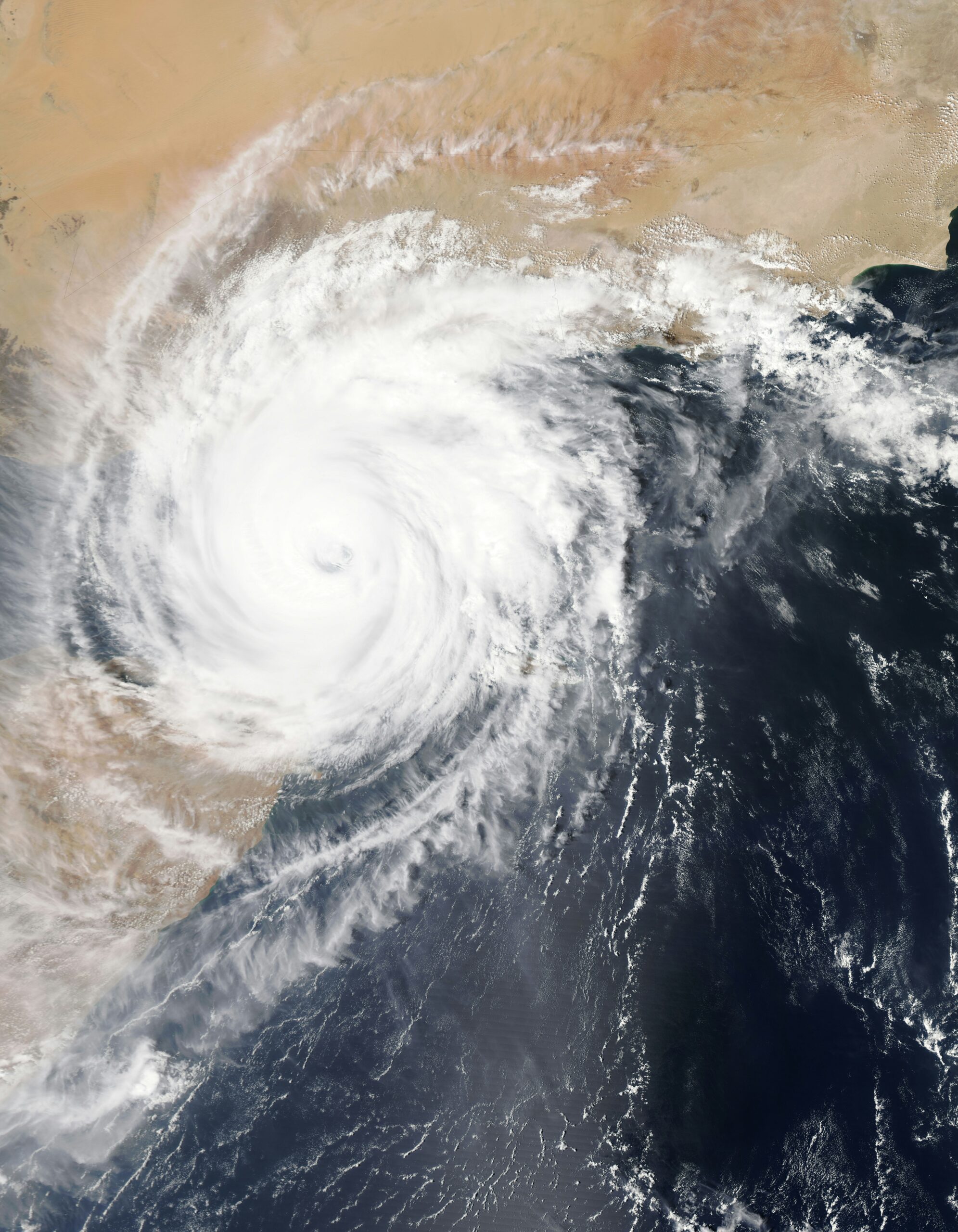
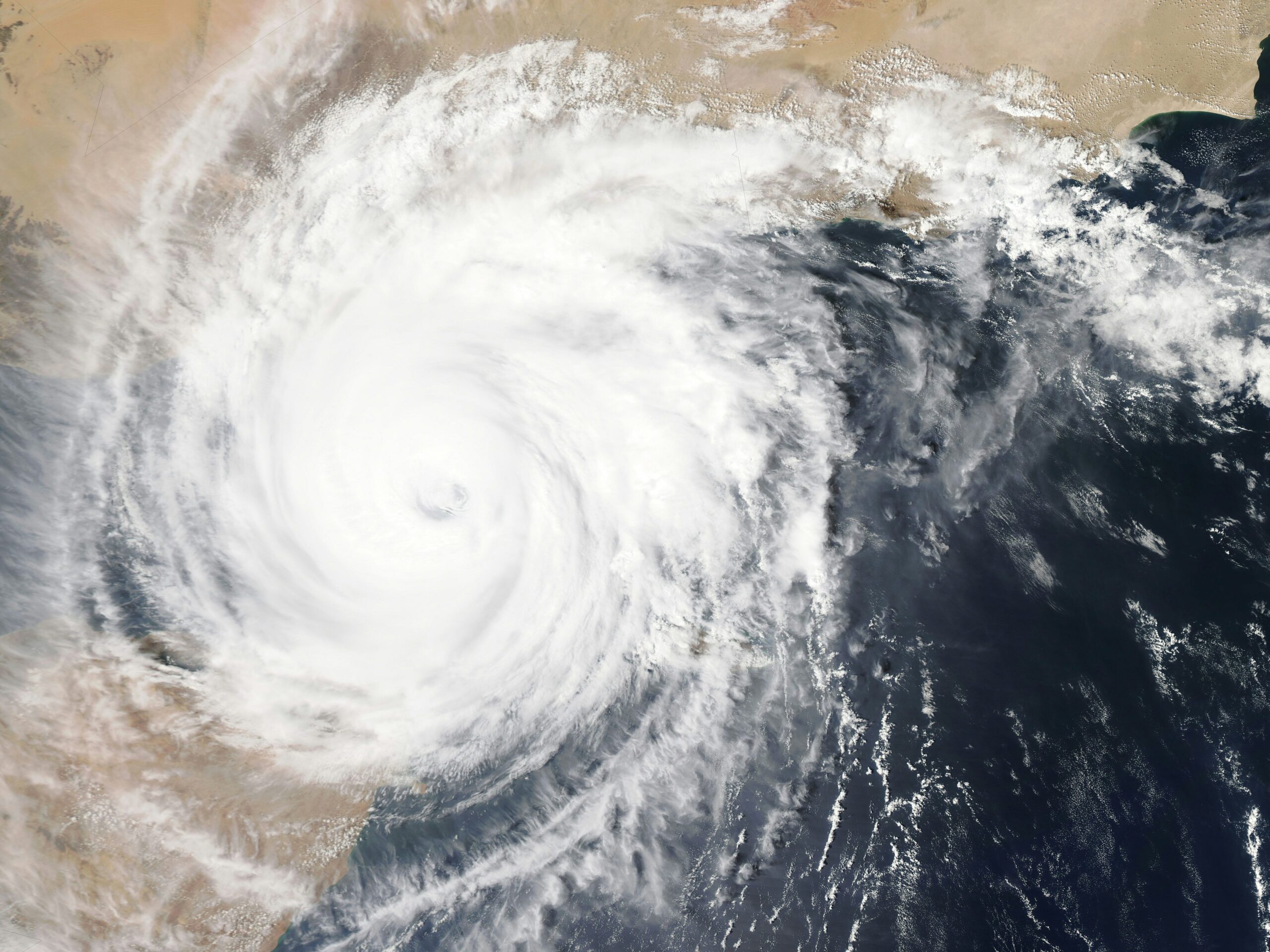
Cyclone Narelle has already packed quite the punch across the Northern Australian Coastline over the past several days, and it is up in the air whether the system will reach as far down as Perth. Jess from the Bureau of Meteorology said, “Watch this space, we could be in for an interesting weekend, but it’s too far out to tell just yet.”

Grey Skies Ahead
Doug and Jess discussed the recent change in weather, with overcast skies, which could imply we are in for a spot of wet weather in the coming days.
“There is a blanket of cloud over the metro area at the moment. It is thinning and clearing ever so slowly,” said Jess.
“Those eagle-eyed among you may have noticed that the weekend is looking a little bit different with some potential showers on the forecast. Now those showers are going to be coming down as a result of ex-tropical cyclone Narelle.”

East to West
She explained that this is a system that crossed the northern parts of the Cape York Peninsula in far North Queensland. It then moved across the Gulf of Carpentaria and crossed the coast over the weekend.
She continued, “It is now slowly starting to move into the WA region. It’s currently a tropical low so it has been downgraded but through into tomorrow we start to see it popping out on the west coast of the Kimberley and starting to move in the waters north of the Pilbara region where it’s likely to regain its tropical cyclone strength and likely to become another severe tropical cyclone.
Same Name Cyclone
This will be the third time in its lifetime that it has gone severe, come down and then been raised up again, according to Jess’ research.
“It is still the same circulation, it’s still tropical low 34U, it will be called Narelle again once it does regain its strength. It’s not a new system so it won’t get a new name.”
In the long term, we will see a few model solutions that bring this tropical cyclone around the corner of the state. She said we need to take the time into account, as a lot can change over the course of a week.
“There is a range of different scenarios for how this is going to look noting that we’re still talking five to seven days away.”

WA Watch and Wait
Jess said that Perth residents in the metro area will need to track the cyclone closer to its arrival.
“So for the residents of the metro area watch and wait with interest keeping an eye on the tropical cyclone forecast track map as that situation develops throughout the rest of this week.”

Do Not Assume the Worst
Jess said that although there are multiple scenarios to consider, it is not worth expecting an extreme case.
“It might be a fairly interesting weekend, but, you know, we can’t hang our hats on a single outcome,” she said, “Take these extreme forecasts with a pinch of salt.”
She encouraged those wanting to track Cyclone Narelle to pay attention to what the Bureau of Meteorology is putting out.
“We are looking at hundreds of different models to work out what the most accurate and most likely path for this system is going to be.”